RANDONNÉES
ITINÉRANCES
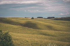
MASSIF CENTRAL
SANS VOITURE
MERS ET ÎLES D'AUVERGNE
Randonnées Occitanie
blabla
carte des randonnées en Occitanie
Utilisez l'outil
pour personnaliser votre carte (fond de carte, véloroute, points d'intérêt...)
Toutes les randonnées en Occitanie
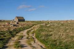
Buron de la Blatte
9km
2h15
D+253m
LIEU DE DÉPART :
Hameau Bonalbert (48)
, randonnée en
boucle
NIVEAU :
facile
VOIR CETTE RANDO
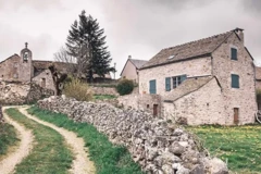
Autour du chateau du Bousquet – Aveyron
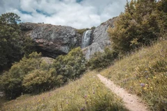
Cascade du Déroc à Nasbinals
10km
2h à 2h30
D+153m
LIEU DE DÉPART :
Nasbinals
, randonnée en
boucle
NIVEAU :
moyen
VOIR CETTE RANDO
Nasbinals, le sentier des granges
6km
1h45
D+128m
LIEU DE DÉPART :
Nasbinals
, randonnée en
boucle
NIVEAU :
facile
VOIR CETTE RANDO
Signal de Mailhebiau, sommet de l'Aubrac
10km
2h45
D+217m
LIEU DE DÉPART :
Croix de la Rode (48)
, randonnée en
boucle
NIVEAU :
moyen
VOIR CETTE RANDO
Saint-Urcize, du village à la station
10km
2h45 à 3h
D+264m
LIEU DE DÉPART :
Saint-Urcize
, randonnée en
boucle
NIVEAU :
facile
VOIR CETTE RANDO
Week-end rando & train dans l'Aubrac
69km
3 jours
D+1300m
LIEU DE DÉPART :
Aumont-Aubrac
, randonnée en
Itinerance
NIVEAU :
Moyen
VOIR CETTE RANDO
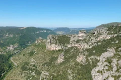
Les balcons du vertige
11km
4h
D+1286m
LIEU DE DÉPART :
Le Rozier (48)
, randonnée en
boucle
NIVEAU :
Difficile
VOIR CETTE RANDO
Gorges du Tarn, Méjean et Blanquefort
11km
4h
D+705m
LIEU DE DÉPART :
Les Vignes (48)
, randonnée en
boucle
NIVEAU :
moyen
VOIR CETTE RANDO
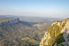
Tour du Pic Saint-Loup
11km
D+643m
LIEU DE DÉPART :
Parking pic Saint-Loup - Cazevieille
, randonnée en
boucle
NIVEAU :
moyen
VOIR CETTE RANDO
Week-end rando et train au lac de Naussac
35km
2 jours
D+585m
LIEU DE DÉPART :
Langogne
, randonnée en
Boucle
NIVEAU :
Moyen
VOIR CETTE RANDO
Rochers de Trenze par le belvédère des Bouzèdes
14km
4h à 5h
D+750m
LIEU DE DÉPART :
Belvédère des Bouzèdes
, randonnée en
boucle
NIVEAU :
difficile
VOIR CETTE RANDO
Boucle du Grand Tanargue
16km
4h à 5h
D+549m
LIEU DE DÉPART :
Col de Meyrand
, randonnée en
boucle
NIVEAU :
Moyen
VOIR CETTE RANDO
De Vimbouches au rocher de l'Angrisio
14km
3h15 à 4h15
D+937m
LIEU DE DÉPART :
Vimbouches
, randonnée en
boucle
NIVEAU :
Difficile
VOIR CETTE RANDO
Les Bondons : de menhirs en menhirs
14km
4h30
D+442m
LIEU DE DÉPART :
Les Bondons (48)
, randonnée en
boucle
NIVEAU :
moyen
VOIR CETTE RANDO
Les gorges du Bramont
10km
3h
D+388m
LIEU DE DÉPART :
Saint-Etienne du Valdonnez (48)
, randonnée en
boucle
NIVEAU :
Moyen
VOIR CETTE RANDO
Sommet du Pic Casini
18km
5h
D+418m
LIEU DE DÉPART :
L'hôpital (Pont-de-Montvert)
, randonnée en
boucle
NIVEAU :
difficile
VOIR CETTE RANDO
Panorama du Cayla dans les Cévennes
6km
D+306m
LIEU DE DÉPART :
Col de la Croix de Bourel (48)
, randonnée en
boucle
NIVEAU :
facile
VOIR CETTE RANDO
Sommet d'Espervelouze et Notre-Dame des Neiges
13km
3h30
D+382m
LIEU DE DÉPART :
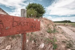
La Bastide-Puylaurent (48)
, randonnée en
boucle
NIVEAU :
moyen
VOIR CETTE RANDO
Garde-Guérin et gorges du Chassezac
9km
3h
D+558m
LIEU DE DÉPART :
La Garde-Guérin
, randonnée en
boucle
NIVEAU :
difficile
VOIR CETTE RANDO
Rochers de Trenze et Gourdouze
19km
6h30
D+1053m
LIEU DE DÉPART :
Vialas (48)
, randonnée en
boucle
NIVEAU :
difficile
VOIR CETTE RANDO
Pont du Tarn depuis Masméjean
15km
D+407m
LIEU DE DÉPART :
Masméjean (48)
, randonnée en
boucle
NIVEAU :
moyen
VOIR CETTE RANDO
Ruas, Puech et Bondons
6km
D+381m
LIEU DE DÉPART :
Ruas (48)
, randonnée en
boucle
NIVEAU :
moyen
VOIR CETTE RANDO
Voir les 20 autres Occitanie
blabla 2
Accueil
Randonnées
Occitanie
Top
Map
Share
 9km
9km 2h15
2h15 D+253m